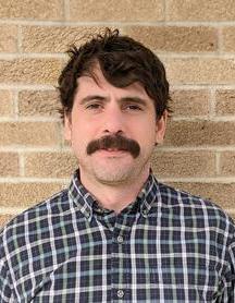
Matt James DiBona, BS Natural Resource of Conservation MA Urban Sustainability and Resilience
Instructor - Adj
Adjunct Instructor
Braunstein Hall
A&S Geography Adjuncts - 0131
Professional Summary
Matthew (Matt) DiBona is a geospatial and natural resource professional with more than a decade of experience advancing urban forestry, parks management, and sustainable land use initiatives. He currently serves as Senior GIS Analyst for the Cincinnati Park Board, where he leads the development of advanced geospatial models and decision-support tools that guide citywide investment in parks, greenspace, and canopy equity.
Matt specializes in GIS analytics, urban sustainability, and innovative funding frameworks that create long-term support for public space and forestry programs. His work includes building the Cincinnati Greenspace Model, Capital Funding Model, and Park Equity Accelerator in partnership with the Trust for Public Land — projects that have contributed to Cincinnati’s national recognition as a top city for park access and quality.
Education
Bachelors of Science in Natural Resource of Conservation: Unvieristy of British Columbia Vancouver, British Columbia, 2010 (Forestry, Conservation, Natural Resource, and GIS)
Master in Arts in Urban Sustainability and Resilience : Xavier University Cincinnati, Ohio, 2019 (Urban Planning, Sustainability, Resilience, GIS, and Public Policy.)
Positions and Work Experience
01-28-2019 - Senior GIS Computer System Analyst, - Developed an asset and preventative maintenance program incorporating equality and environmental justice to manage infrastructural improvements. - Implemented model-based capital infrastructure project management software for 30 million in investment Developed GIS parcel modeling to streamline annual property assessment processes. - Launched the current tree and asset inventory system with over 70,000+ assets inventoried - Designed an industry-first GIS Urban Forestry Street and Park geospatial risk evaluation plan - Led the initiative to enhance the 2020 tree canopy analysis by forming an interdepartmental relationship to disseminate the significance and benefits to the overall city. , Cincinnati Park Board, Cincinnati
2017 -2019 Forestry Consultant, Assisted family-owned Fair Trade coffee plantations in the rural mountains of the Dominican Republic to produce higher yields and better quality Implementing proactive plant health care and disease control practices Developing geospatial tools to assist in environmental and sustainability goals , Better World Beans,
2010 -2016 District Manager, Assistant Direct Manager, Project Manager , Directed large-scale federal and state forestry contracts with the USDA. Managed 50–60+ employees across multiple projects, overseeing hiring, training, safety, and compliance. Coordinated with government agencies and external stakeholders to meet regulatory and contractual requirements. Developed protocols, improved GIS operations, and implemented cost-saving measures that increased efficiency and profitability., Davey Tree Expert Company , Massachusetts, New York, New Jersey, & Ohio
Publications
Technical Reports
(2021) Cincinnati Tree Canopy Assessment (2011-2020) .
Courses Taught
GEOG-6071C: Intro to GIS Level:Graduate
GEOG 5176C/6076C: Environmental Remote Sensing
Contact Information
Bettman Natural Resource Center
4 Beech Ln
Cincinnati
Ohio, 45208
Phone: 513-321-6070
matt.dibona@cincinnati-oh.gov